Following Lorna Doone in Exmoor: A Literary Heritage Trail
A practical guide to the Exmoor places behind R. D. Blackmore's Lorna Doone, from Badgworthy Water to Oare...

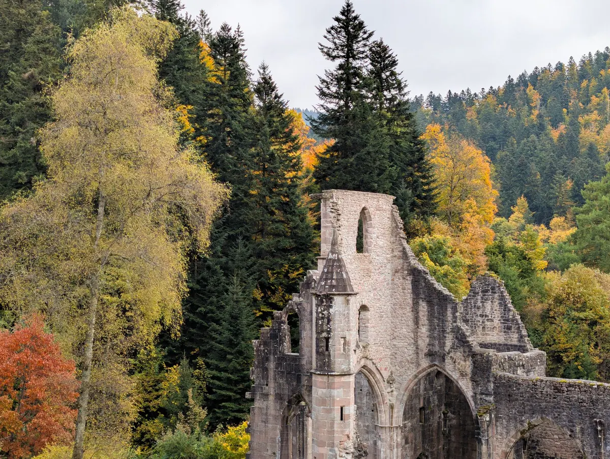
Glastonbury has two landmarks that most visitors come for, and they sit less than a mile apart. Below, in the town, are the ruins of Glastonbury Abbey — arches, walls and tower stumps set among lawns. Above, at the end of a steep footpath, rises Glastonbury Tor, the conical hill topped by the empty tower of St Michael's Church. Each makes sense of the other: the abbey was one of the wealthiest monasteries in medieval England, and the Tor was the hill its monks looked up at every day — and where the last abbot died.
Geography explains a good deal here. Glastonbury sits on a low ridge surrounded by the flat, wet ground of the Somerset Levels, which for much of the year in the Middle Ages was genuinely marshy. The Tor is the highest point for miles, a natural beacon visible from the Mendips and the Quantocks, and from parts of the Bristol Channel coast on a clear day.
That combination — a safe dry island with a conspicuous hill beside it — is why the site attracted a monastery so early. Pilgrims often arrived by boat across the Levels rather than by road, and the abbey grew rich on their offerings. The Tor and the abbey were part of the same estate and the same devotional landscape; walking between them is still the best way to understand the place.
A monastery existed here by the seventh century, and the abbey was reformed and expanded in the tenth century under Dunstan, its abbot and later Archbishop of Canterbury. The scale of the ruins you walk through today, though, comes mostly from what happened after a disaster.
In 1184 a serious fire destroyed much of the abbey church. Rebuilding began almost at once, funded by a growing stream of pilgrims. The Lady Chapel was raised on the site of the community's oldest church, and a vast new Great Church rose behind it. In 1191 the monks announced the discovery of the graves of King Arthur and Queen Guinevere in the abbey grounds — a find that put Glastonbury on the pilgrimage map for good. The remains were reburied in front of the high altar in 1278.
By the fourteenth century Glastonbury was among the richest monastic houses in England. That wealth made it a target. The abbey was dissolved in 1539, its last abbot, Richard Whiting, was executed on the Tor, and the buildings were stripped of lead and stone. What you see now is the skeleton of a great church, plus the surviving Abbot's Kitchen, a square building with a pyramidal roof that is one of the best-preserved monastic kitchens in the country.
Glastonbury's legends matter to visitors, and it helps to know roughly when each one appeared.
The identification of Glastonbury with Avalon began in the Middle Ages, and the 1191 exhumation was, at the very least, well timed. Medieval chroniclers recorded it as fact; modern historians treat it as a claim by a monastery in need of pilgrimage income. Either way, you can stand where the grave was said to be.
Medieval tradition held that Joseph of Arimathea came to Britain and founded the first church at Glastonbury. The Grail connection is later and mostly literary — a medieval romance and, much more recently, twentieth-century writers. It is a story worth enjoying as a story.
The Glastonbury Thorn, said to have sprung from Joseph's staff, flowers around Christmas and again in spring. Grafted descendants grow in the abbey grounds and elsewhere in town. Pilgrims still send sprigs to the monarch at Christmas, a custom that outlasted the abbey itself.
The summit sits roughly 158 metres above sea level, which is modest, but the climb is steep and short rather than gentle and long. From the edge of town, allow twenty to thirty minutes up at a relaxed pace. National Trust footpaths lead from near Wellhouse Lane and Chilkwell Street, and the field is grazed for part of the year, so keep dogs on leads and close gates.
The terraces cut into the slopes have never been fully explained. Suggestions include farming, a processional route and a defensive earthwork; a popular modern theory sees a spiral labyrinth. All are theories, not settled fact.
On top, the fourteenth-century tower of St Michael's Church is a Scheduled Ancient Monument — admire it, don't climb it. An earlier church on the site was rebuilt after a thirteenth-century earthquake. The views are the reward: the Levels laid out in fields and ditches, Brent Knoll and the Mendips to the north, the Quantocks to the west. Take a windproof layer; the summit is exposed and often several degrees colder than the town.
Glastonbury rewards a bit of preparation and a willingness to walk. Read the abbey's interpretation boards, treat the legends as legends, and let the landscape do the rest. If you have time, come back in winter — the Levels mist over, the Tor stands clear above it, and you will see why people here believed it was a place set apart.
Photo: Adrien Stachowiak / Pexels
A practical guide to the Exmoor places behind R. D. Blackmore's Lorna Doone, from Badgworthy Water to Oare...
A three-hour plan for Wells Cathedral's highlights, from the west front to the chapter house, plus...
A step-by-step walking route through Dunster's castle, Yarn Market, watermill and old streets, with the...